Start
November 20, 2020 - 7:00 pm
End
November 20, 2020 - 9:00 pm
This was the case for a village living near Gunung Leuser National Park, whose residents had limited access to health services and information. In such situations, it is common for them to turn to illegal logging to pay for medical treatment.
Enter Healthy Planet Indonesia (HePI), an organisation that aims to integrate conservation and healthcare through community-based projects.
By providing dental care incentives to the residents, it hopes to reduce their dependence on deforestation and land encroachment to close the economic gap.
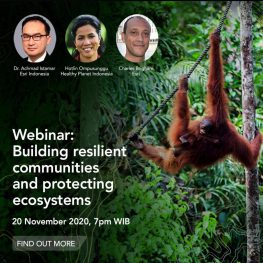
In this webinar, you’ll learn how Esri Indonesia has collaborated with HePI and used GIS to support its conservation efforts, and monitor and manage the health data of the Gunung Leuser National Park community.
There’ll also be a quiz on Gunung Leuser National Park where you could win Esri Indonesia merchandise, as well an opportunity to contribute to its conservation efforts!
MORE DETAIL
Website
Register yourself through https://esriindonesia.co.id/events-calendar/location-intelligence-building-resilient-communities-and-protecting-ecosystems
Register


